地図サーバの設定(管理者向け)
�向け)地図サーバとは、複数のネットモーフのイメージに、世界地図を配るためにあります。論理的なもので、すべてのネットモーフに入っています。通常は、地図サーバの役割を果たすイメージが自動的に決まります。ユーザはどのイメージが地図サーバなのか、意識する必要はありません。
しかし、管理上、地図サーバを明示的に定めた方が都合の良い場合もあります。
(特に教室内のワークショップで使う場合など)
そのために用意されているのが地図サーバ用のイメージ(もしくはsar)になります。これはNetMorphから地図サーバ部分だけを切り出したものです。通常のネットモーフイメージよりも軽量で、他のイメージからのワープ攻撃も受けません(教室内ではよくこのようなことが起こります^^;)。地図サーバを使うと、安定した状態で、地図を各ネットモーフイメージに配ることができます。
ここでは地図サーバ専用イメージを使う場合の設定方法を説明します。
クライアント側(通常のネットモーフイメージ)の設定
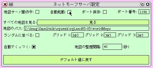
クライアントは、もはや自動的に地図サーバになったりする必要がありませんので、その機能をオフにします。具体的にはフラップから「セットモーフサーバ設定」を取り出して、「地図サーバ動作中」と「自動起動」の項目をオフにします。
地図サーバ側
地図サーバ専用イメージを立ち上げた場合、すでに以下のような設定になっています。一応、確認してください。「セットモーフサーバ設定」を見ると、「地図サーバ動作中」がオンになっています。
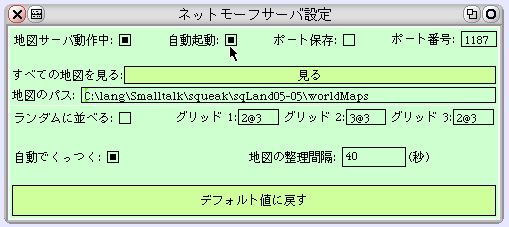
もう一つ、注目すべきは「ポート番号」です。ランダムに使われていないポートが選ばれるようになっていますが、ファイアウォールの設定の関係などで、あるポートに限定したい場合、ポート番号を手動で入れ直して(リターンで確定します)、「ポート保存」をオンにしておくと良いでしょう。
再びクライアント側
さて、これで設定は終わりです。クライアント側で地図サーバが正しく参照できているか、確認してみましょう。
「ネットモーフ設定」を見ると、「地図URL」が、マップサーバのポート番号を示しています。